A new app from FAU enables laypersons to document archaeological finds
A freshly-plowed field. There is something shiny sticking up between two lumps of earth – an unspectacular shard of pottery or maybe just a stone. However, a closer look could reveal a piece of history. This is where a project from the Institute for Prehistory and Protohistory at Friedrich-Alexander-Universität Erlangen-Nürnberg (FAU) comes in. In conjunction with the Bavarian State Office for the Preservation of Historical Monuments (BLfD) and the Gesellschaft für Archäologie in Bayern, researchers at FAU have developed an app that laypersons can use to document and report archaeological finds. Prof. Dr. Thorsten Uthmeier, Chair of Early Prehistory and the Archaeology of Prehistoric Hunter-Gatherers at FAU explains what the ASTRAcker app is all about.
Why an app?
In archaeology, we rely heavily on what’s known as “citizen science”, or the help of laypersons, who are usually volunteers at the state offices, who keep their eyes peeled when they go out for walks in the countryside or systematically look for evidence from the past while walking over fields. In Bavaria alone, there are few thousand people who do this. We developed this app to enable these dedicated volunteers, who are sometimes extremely well informed, to document their finds easily on site and above all, in a manner that we can later use in our research.

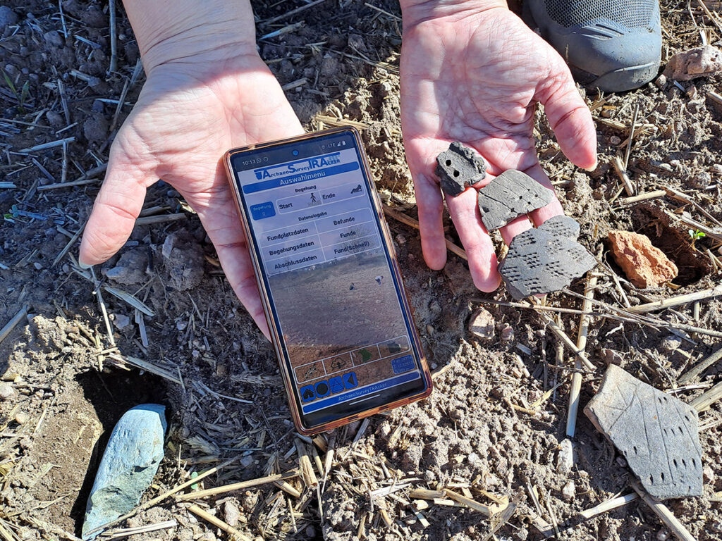
(Image: Axel König/StMWK)
How exactly does the app support users with identifying finds correctly and reporting them?
It makes everything much easier. Up to now, there was no software in Bavaria for documenting finds easily with a smartphone on site. Often only a rough indication of the location of the find was given, some people used meter steps, while others used GPS devices in order to record the position of finds. There was a form on paper for recording finds to the Bavarian State Office for the Preservation of Historical Monuments. The app, on the other hand, enables users to merge data on site with just a few clicks, such as the GPS coordinates of the find location, a photo of the find, information about the weather and the conditions of the site or a description of the location of the find, for example, if it was discovered on level ground or on a slope, whether the site is freshly plowed, what else is visible, and so on. The great thing about the app is the online interface to an online database designed by the State Office for the Preservation of Historical Monuments, which sends all data to the office at the touch of a button. In the database, finders can display their find locations and finds in lists and even show them on a map, simply by using the app. The complete package comprising the smartphone app and the online database enables those interested in archaeology not only to document their finds on location, but also to make initial scientific analyses.
(Image: BLfD)
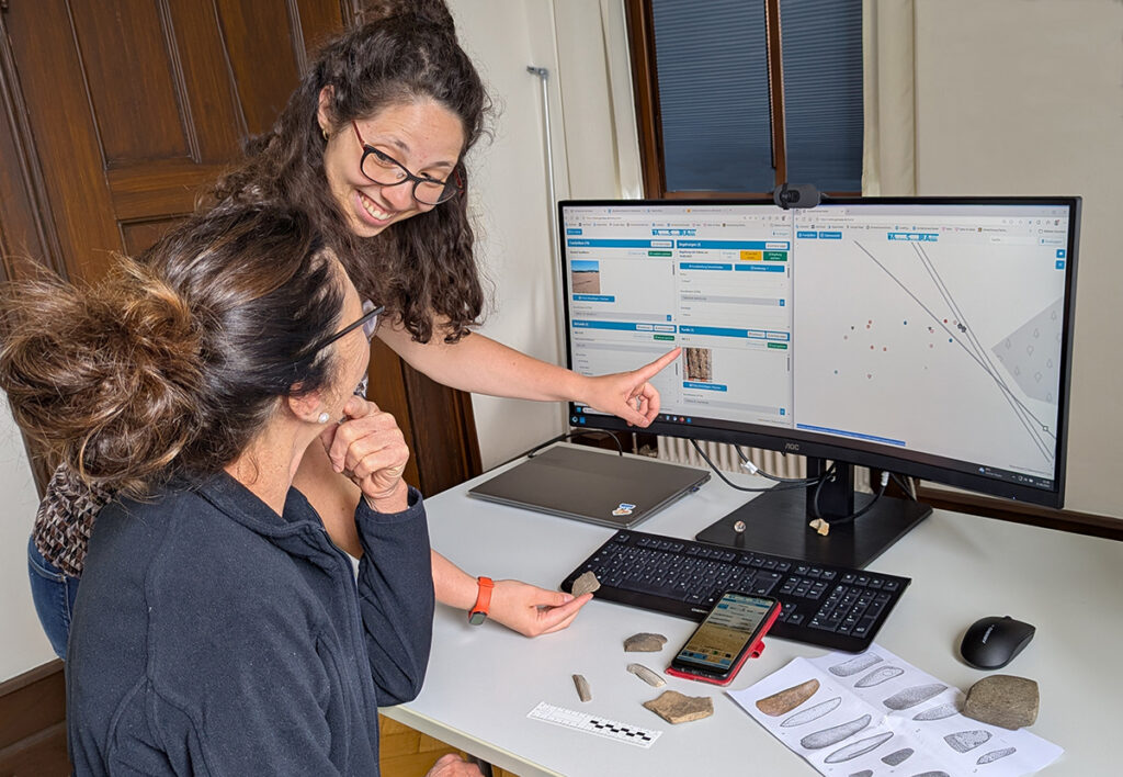
At the State Office for the Preservation of Historical Monuments, staff decide whether a find location will be entered into the list of archaeological sites. What may sound like a boring piece of bureaucracy, is decisive for the future of the sites of archaeological finds: Without such records, information that could be decisive for regional history could be lost forever because of building projects and so on. The specialists at the State Office also decide, for example, if emergency excavations need to be carried out since laypersons are not permitted to undertake any kind of excavations themselves.
The contribution made by volunteers cannot be overstated. Around 90 percent of archaeological sites in Bavaria […] were discovered due to their dedication.
Prof. Dr. Thorsten Uthmeier, Chair of Early Prehistory and the Archaeology of Prehistoric Hunter-Gatherers
You mention volunteers quite often. What role do laypersons play in modern archaeology?
The contribution made by volunteers cannot be overstated. Performing systematic searches, for example on fields, are among the classic methods for discovering new archaeological find locations. This is something that many people who are interested in history do in their spare time. There are several hundred of them in Bavaria alone. Around 90 percent of all archaeological sites in Bavaria, ranging from Paleolithic camps from the time of the Neanderthals and the first settlements established by the first farmers to Medieval fortifications, have been discovered only thanks to their dedication.
Where did the idea for developing an app for archaeological searches come from?
There’s a backstory behind it. While researching human footprints in caves in France, my colleague Andreas Pastoors and I worked with tracking experts from Namibia.
The San peoples are excellent trackers and many of them document the tracks of animals using an app called CyberTracker. This app enables them to store images, geodata and information about the location of the tracks, the species of animal, its sex, the type of track, and so on with a smartphone. The principle is identical to what we need in archaeology when someone discovers an archaeological find. Back at FAU, we researched with our students for several semesters into what software is already available for this purpose and we also tested it. In the end, we decided to use the CyberTracker software from South Africa, which is available free of charge, that we then adapted in conjunction with the Bavarian State Office for the Preservation of Historical Monuments and the Gesellschaft für Archäologie in Bayern in such a way that it can be used by both scientists and laypersons. This is how the ArchaeoSurveyTracker came about.
Does this mean I can use the app this weekend to look for archaeological sites?
There a few things to consider before you set off to look for artifacts from the past. For example, you must seek permission from the owner or tenant of the land before you start your search. Everything you find belongs to society, or the State of Bavaria, and therefore has to be reported. And please, please don’t start digging!
It’s not just the find itself that’s important to us as researchers. The location where an object was found can tell us a great deal about its owner and their history. This means that the find location needs to remain untouched until a team of archaeologists arrives. Without precise documentation of the location of the find, the archaeological layer and the accompanying finds, archaeological finds are almost worthless.
The app itself is available via the Bavarian State Office for the Preservation of Historical Monuments. The State Office and the Gesellschaft für Archäologie in Bayern also provide training for those interested in exploring history as a volunteer.
Further information:
Prof. Dr. Thorsten Uthmeier
Chair of Prehistoric Archaeology